
Cave Spring Neighbor Sources by Block
Immediate neighbors are best researched parcel by parcel. Roanoke County GIS shows the land geometry and nearby parcel IDs, while WebPro adds assessment fields for each parcel. The Circuit Clerk's recorded land records can establish an ownership sequence. Voter information is more limited: the county's public VoterView tool focuses on a selected address, parcel, owner, polling place, and district, not a complete roster for a block. Public association contacts are another community layer, not membership lists.
| Source | What It Shows About a Block | Access |
|---|---|---|
| County GIS parcel layer | Target and adjoining parcel shapes, IDs, zoning, flood, school, and district context | Public county map; enable pop-ups if needed |
| WebPro property search | Owner, situs, assessment, sale, and parcel fields for one parcel at a time | Free county search |
| Circuit Clerk land index | Ownership sequence and legal description for an adjacent parcel | Paid SRA, Clerk counter, or LVA fallback |
| Voter records | Limited lawful voter fields and selected-address polling information | Statutory rules and permitted request paths apply |
| Civic and HOA contacts | Public meeting or management route for a community | County inventory or association site; no public member roster |
A parcel neighbor is not always a social neighbor. A road, creek, common area, right-of-way, or vacant tract can sit between the nearest homes. The map answers land adjacency; it cannot establish who knows whom or who uses a shared drive.
Begin with a single target parcel and a narrow purpose. A clear record packet has the target parcel, inspection date, adjacent parcel IDs, map-layer names, WebPro fields, a relevant deed or plat reference, and a public community contact if one exists. It does not need a recreated neighborhood roster. That approach also makes a later correction possible when assessment or map data changes.
Map a Cave Spring Block From One Parcel
Use the county map to make a small, auditable neighborhood record. The official static information confirms parcel maps, pop-ups, property-report links, and thematic layers, but it does not document a stable adjacent-parcel or radius-selection control. Click each adjoining polygon rather than assuming a radius tool exists, and keep the map's inspection date with the result.
- Search the starting address in Roanoke County GIS Services, then turn on parcel boundaries and zoom to the street segment.
- Open the target parcel pop-up and record its parcel ID, situs, and the date checked. Follow the property-report link where available.
- Click each parcel polygon that actually adjoins the target. Record parcel ID and situs before visiting its separate WebPro card.
- For each adjacent parcel, compare the current WebPro owner field with the map, sale reference, and legal description. Use a deed or plat when the boundary is unclear.
- Keep zoning, flood, school, and district layers as context. Do not convert them into claims about who resides on a block.
The larger chain for an entire named road belongs with the Cave Spring street directory. A neighbor inquiry should stay focused on the immediate parcel layer and any relevant community contact.
Cave Spring Neighbor Map Layers
County GIS can layer parcels with zoning, flood zones, school boundaries, magisterial districts, fire hydrants, and address-linked applications. A flood or zoning overlay can explain why adjoining parcels look different or why land is held by an association or public body. It does not identify people. Police View is limited to past 30-day crime information and is also not a resident source.
GIS refreshes on Thursday evenings and may take up to two hours. WebPro assessment information can update on a different schedule. When comparing Cave Spring neighbors, preserve the field as it appeared on each source and avoid harmonizing a date that the county has not synchronized.
Property Report and TaxView can carry an address or parcel toward assessment and tax information, Citizen Connect can lead to permit information, and VoterView can provide polling context. Each application has a narrower function than the map. A school boundary, flood zone, or elected-official tab describes service geography, not a person's identity or current presence at a home.
Compare Cave Spring Neighbor Owners and Situs
WebPro is free to search by owner, address, parcel, sales information, and property characteristics. It returns a parcel's situs and visible owner, but the owner line is not a list of occupants. The mailing address may be a different Virginia address, an out-of-state address, an estate, an organization, or a tax-service address. A group or government owner can also appear on a common area, right-of-way, or institutional parcel.
Open the parcel card before relying on a result list. Note the parcel, location, owner, sale reference, and assessment date, then distinguish the record role from a statement about who is present. A parcel search has value because it is specific and reviewable, not because it supplies a complete household profile.
Check Cave Spring Neighbor Deed Boundaries
The Roanoke County Circuit Court Clerk records deeds, plats, easements, powers of attorney, and other land instruments. For each adjacent parcel, a recorded purchase deed may reveal a grantor, grantee, recording date, book/page, and legal description. The county's Secure Remote Access service covers the deeds and land index from 1838 to current records, but remote access requires Clerk approval, login, and a paid subscription.
When a modern parcel edge does not fit an old instrument, a plat may explain a common area, access easement, lot line, or subdivision boundary. The Clerk counter and the Library of Virginia microfilm guide are alternatives for older material. Do not treat a financing record, release, or easement as proof that a person lived at the parcel.
Cave Spring Neighbor Voter Limits
Virginia Code §24.2-444 describes public voter-list fields that can include name, residence address, year of birth, gender, and election districts, with exclusions for Social Security numbers, day and month of birth, a P.O. box used in place of residence, declination, and registration-agency details. ACP and other protected voters receive special handling. Those limits matter even when a property is easy to find on a map.
Roanoke County VoterView searches owner name, address, parcel, or map location for polling and official information. It is not a block-wide voter query. A separate voter-list request has a use attestation and restrictions under §24.2-406; a persons-who-voted list never reveals a ballot choice. Use the statutory route for a permitted civic purpose, not casual address collection.
Public Contacts for Cave Spring Neighbors
Roanoke County's community and civic-group inventory is a route to public meetings and contacts, not a directory of the people who belong to a group. The county page lists names including Back Creek Civic League, Brookfield HOA, Carriage Hills HOA, Farmington Place HOA, Highfields Homeowners, Huntridge Grove HOA, McVitty Forest HOA, Old Mill Forest Association, Orchard Park Civic Association, and The Orchards Civic Association. The research does not establish a geographic boundary for every name, so verify a group's service area before assigning it to an address.
| Public contact layer | What is public | Careful use |
|---|---|---|
| County civic-group inventory | Group names and public meeting/contact routes | Confirm the neighborhood boundary; no member roster is published. |
| Back Creek Civic League | County inventory listing | Do not assume its area covers a specific parcel without confirmation. |
| Brookfield, Carriage Hills, and Farmington Place | HOA names in the county inventory | Use only public contact or meeting information. |
| Kenwick Place | Public management contact and notices | Private HOA site, not an official county resident source. |
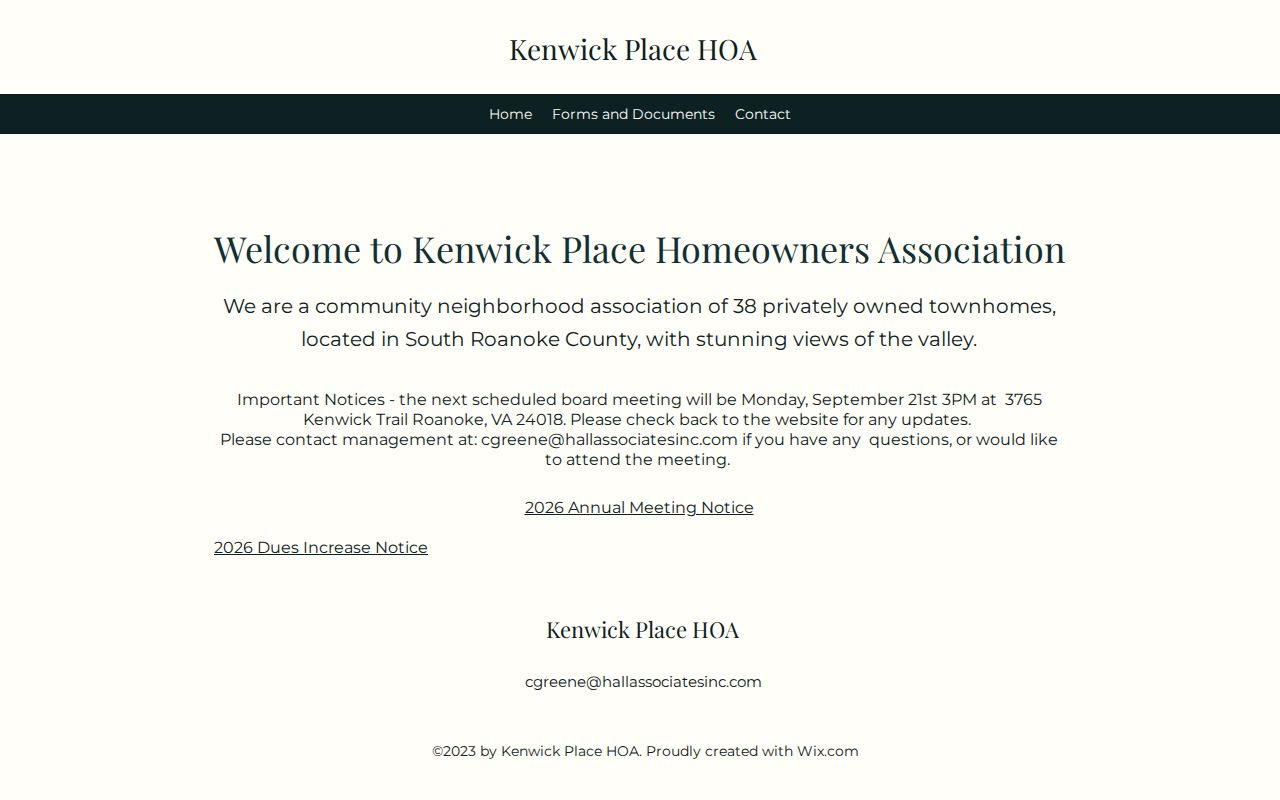
The Kenwick Place public HOA site is the source shown below. It describes public notices and a management contact for 38 privately owned townhomes, but it does not publish a member roster. That difference is useful: community contact can support a legitimate local question without disclosing private membership.
For neighborhood history, the Virginia Room, South County Library, and Historical Society of Western Virginia can provide directories, newspapers, photographs, cemetery files, and maps. Those collections document past context, not a current private-contact list.
Public meeting notices can identify a route for a civic question, but they do not prove attendance, participation, or residence. Where a community-history question requires context, ask the Virginia Room or HSWV for a historical neighborhood file rather than trying to infer private affiliation from a similar neighborhood name or WebPro code.
Cave Spring Neighbor Tool Comparison
Official and compiled neighbor tools answer different questions. A useful comparison starts with the original record: its office, date, parcel, and legal limits can be checked. A commercial compiled profile may merge property, marketing, and other data, yet may be stale, incomplete, or linked to the wrong person. Neither category should be treated as proof of present occupancy without a dated, relevant record.
| Tool category | Best for | Key limit |
|---|---|---|
| Official parcel and deed records | Land identity, recorded owner role, dates, and legal description | Ownership does not prove who occupies the address. |
| Official voter and community sources | Selected-address voting context and public meeting routes | Statutory limits and no private membership roster. |
| Commercial compiled neighbor tools | Possible leads to verify independently | Can be stale, wrong, or unclear about source and date. |
Use the county office to correct an assessment issue, Elections for voter information, and the association's public contact for community questions. An original source and a clear date give a more trustworthy answer than a long unverified list.
Privacy Limits for Cave Spring Neighbors
Public land records do not reveal every person on a block. Renters, other household members, utility customers, DMV addresses, protected ACP locations, and ballot choices are not general public neighbor-lookup fields. A directory householder, recorded owner, selected voter record, and current resident can all be different people. Remove unnecessary personal details before sharing any research notes.
Virginia's Address Confidentiality Program offers eligible participants a substitute mailing address and protects the physical address subject to statutory exceptions. Do not try to infer or reconstruct an ACP location from parcel, map, or directory information. When a contact request concerns a protected person, use the appropriate official or advocate route instead.
Lawful use. Cave Spring neighbor research can support community history, property curiosity, reconnecting, and civic participation. Never use it to stalk, harass, intimidate, or expose a person.