
Cave Spring Previous Residents by Era
The backward trail for one Cave Spring address is county based. WebPro and GIS supply a current parcel anchor, the Roanoke County Circuit Court Clerk keeps the land-record path, and library or archive sources fill historical household evidence. Cave Spring has no confirmed standalone historical directory series, so old entries may appear under Roanoke, Salem, Vinton, a route label, or a neighboring post office. Start with the source closest to the period being investigated, then corroborate it with a second dated source.
| Source | Years It Covers | Where Held | What It Shows |
|---|---|---|---|
| Circuit Clerk deeds and land index | 1838 to current | SRA and Clerk | Grantors, grantees, instruments, and land descriptions |
| LVA grantor/grantee guide | 1838 to 1923 indexes | Library of Virginia microfilm / ILL | Older deed-index route and listed deed books |
| Roanoke city-directory series | 1888 to present series | Virginia Room | Dated household, address, and occupation clues |
| Federal census | Public releases through 1950 | NARA and library databases | Household composition in census geography |
| Sanborn and permits | 1889 map; permit start not verified | LOC, Citizen Connect, or county request | Building or work context, not an occupant roll |
Ownership records are usually the strongest starting point for a house-history question. Directory and census evidence then tests whether a person or household appears at an address during a particular period.
Anchor Cave Spring Previous Residents to a Parcel
Begin with the current card in Roanoke County WebPro, then view the same land in County GIS Services. Copy the parcel ID, exact situs, current owner, sale date or book/page reference if visible, subdivision or lot information, and the date checked. The county tax-map number is the durable bridge when an older deed uses a tract, adjoining owner, road, or legal description instead of a modern street number.
WebPro's owner and mailing fields are not an occupancy record. A seller, trustee, estate, company, or tax-service address can appear in a property trail without identifying who lived in the building. Use the assessment card to locate the land, then make a separate dated residence finding from a directory, census, obituary, probate filing, or other appropriate source.
WebPro can also search by street, owner, parcel, book and page, sale date, value, land-use code, and building characteristics. Its result columns can sort by location, owner, value, sale data, and book/page. That makes the book/page reference useful as a bridge into the Clerk's record trail, but it is not a complete legal description. Capture the detail card before a later assessment update changes the visible summary.
Follow Cave Spring Previous Residents Through Deeds
The Clerk's land-record index reaches to 1838, the same year Roanoke County formed. The current acquisition deed often provides the next name and an older book/page or legal reference. Use that reference to move backward rather than assuming an older document will carry the same street number. A legal description can follow a lot through a change in road name, parcel split, or reconfigured tax map.
- From WebPro, record the current owner, parcel, sale reference, and exact situs.
- In Secure Remote Access, search the current owner as grantee around the sale or recording date, then capture the purchase deed's grantor, date, instrument, and legal description.
- Search that seller, now acting as grantee, in the earlier period. Compare the parcel, lot, acreage, plat, and prior-reference language before treating it as the same land.
- Repeat the seller-as-grantee step through each confirmed transfer. Search name variants, spouses, estates, trustees, and organizations when the instrument requires it.
- When the remote record stops, use the Clerk counter or Library of Virginia reels and deed books. Keep each book, page, reel, and date with its source note.
- Grantor
- The person or entity transferring an interest in land in an instrument.
- Grantee
- The person or entity receiving that interest. A prior seller is often searched as a grantee to find the earlier purchase.
- Chain of title
- The confirmed sequence of recorded transfers for the same land, not a list of every person connected to the address.
- Legal description
- The recorded land identity, such as a lot, block, tract, or metes-and-bounds description, used to confirm land when street labels differ.
Cave Spring Previous Residents Before 1924
Land records are public, but the Clerk's Secure Remote Access service is a paid remote interface. It requires an application, agreement, approval, login, and at least three months of access for $125. The exact post-login field set was not exposed during research, so fields and images should be checked in the approved account rather than assumed. Clerk counter access and archival sources remain important alternatives.
The Library of Virginia Roanoke County microfilm guide is the source shown below. It lists grantor/grantee indexes from 1838 to 1923, release indexes, deed books, plat books, and surveyors' books, with many reels marked for interlibrary loan. This archive route can be less costly than a remote subscription and is often more useful for an earlier portion of the chain.
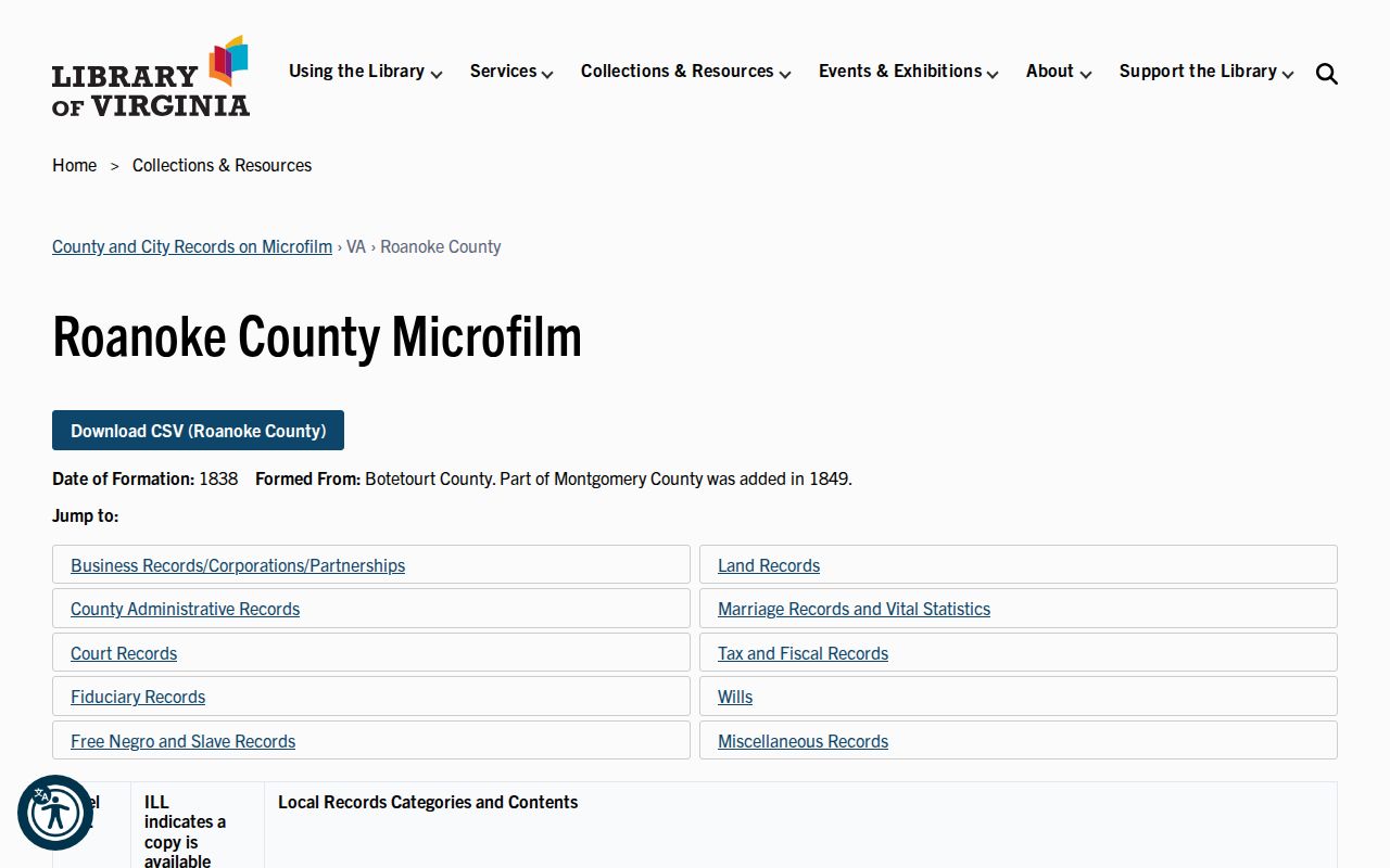
The guide identifies a record series or reel, not a completed house history. Check the actual index and book page, then preserve the citation with the parcel or legal-description evidence.
Coverage differs by series. The SRA land index reaches far back, while other series have separate image or index starting points. Older land material may be easier to inspect at the Clerk, through LVA microfilm, or with library assistance. A remote screen that does not show an image is a prompt to use that fallback chain, not evidence that the public record disappeared.
Bridge Cave Spring Address Records With Plats
Plats translate the legal description into lots, blocks, boundaries, easements, and subdivision layout. Roanoke County's SRA lists survey plats from 1838 forward, and the Library of Virginia guide identifies plat books for 1868, 1927, and 1947 along with surveyors' books from 1840 to 1920. A plat is particularly useful when a current parcel was split or combined and an older deed identifies acreage or an adjoining owner instead of a street address.
No authoritative Cave Spring-wide renumbering or renaming project was found. Do not borrow a City of Roanoke change for an unincorporated county address. Compare the parcel, subdivision, road description, post-office label, and adjacent land in the actual source. Roanoke City's 1968 independent-city status is another reason an old Roanoke label needs a jurisdiction check.
Pair Cave Spring Previous Residents With Census
After the deed chain identifies the land, find who lived there before through dated household sources. The Roanoke City directory series begins in 1888 at the Virginia Room, but exact Cave Spring inclusion varies. Search both the alphabetic section and any street or reverse section, then test Roanoke, Salem, Vinton, and route labels. The historical collections themselves are detailed in the Cave Spring city directory notes.
- Capture an address, spelling, occupation, spouse or household notation from a directory year.
- Match the entry to the closest released federal census, using age, household composition, and place labels to distinguish similar names.
- Check a deed or plat before carrying the household from an old printed street address to a modern parcel.
- Repeat in adjacent directory years. A disappearance can reflect a move, death, marriage, boundary, spelling, or a missed edition.
The federal census is decennial, not annual, and public releases extend through 1950 under the 72-year rule. A directory entry may show a householder or subscriber rather than every resident, so the two records should be read together rather than substituted for one another.
Date a Cave Spring Previous Residence
Sanborn Fire Insurance maps can establish building footprint, street naming, use, and nearby features, but they do not identify every occupant. The Library of Congress 1889 Roanoke set has 16 sheets; check whether a particular address area is actually covered before using it. A county permit application can add work dates or status through Citizen Connect, yet the exact historical coverage and complete field inventory were not verified.
Safer building-date evidence combines the tax-card construction year, a permit or county file, first directory appearance, deed recording, and a newspaper address reference. South County Library offers a microfilm reader with free scans to email or flash drive, while the Virginia Room and Historical Society of Western Virginia can supply newspaper, map, neighborhood, photo, or house-material leads. None of those sources by itself proves a continuous line of occupants.
The Historical Society of Western Virginia holds Greater Roanoke Valley material from the 1740s through the early 2000s, including neighborhood files, house and subdivision blueprints, maps, photographs, and family papers. Its online catalog is a discovery tool, and many items are not digitized. Ask for a collection, box, folder, reel, or page citation rather than assuming a catalog hit supplies a complete record.
Close Cave Spring Previous Resident Trails
Obituaries, probate files, cemetery references, and local newspapers can help close a historical trail. The Virginia Room has Roanoke Times and other local runs, and South County's available microfilm covers the Roanoke Times from August 1969 through November 2014 and the Salem Times Register from 1951 through 1971. The Historical Society of Western Virginia also holds family, neighborhood, cemetery, map, and photograph material, though its catalog is not a guarantee that every item is online.
A probate file may name heirs or an executor, while an obituary may provide a date, relatives, church, cemetery, or final address. Verify those relationships with the Clerk or other primary record where possible. The aim is a documented house-history timeline, not a claim that every name in an archive was a permanent resident.
Respect Cave Spring Previous Resident Limits
Previous residents research is suited to family history, local history, estate questions, and personal curiosity. It should not expose sensitive details about living people. Recorded ownership does not establish occupancy, utility customers are not a public roster, and Virginia's Address Confidentiality Program protects eligible participants' physical addresses. Historical printed information also should not be treated as a current address.
Lawful use. Use a Cave Spring address trail to understand a property and its past. Do not use it to locate, watch, harass, intimidate, or expose a living person.