
Cave Spring ZIP Code Directory
ZIP codes describe Postal Service delivery geography, not the legal extent of Cave Spring. The local ZIP polygon layer makes 24018 the primary Cave Spring-area mailing ZIP, but every edge address still needs a USPS result. The adjacent codes below are caution labels, not a claim that each lies inside the Cave Spring Census Designated Place or Community Planning Area.
| ZIP | Areas Covered | Post Office | Notes |
|---|---|---|---|
| 24018 | Primary Cave Spring-area mailing geography; county pages use Roanoke VA 24018 for local addresses | Roanoke VA 24018 | Primary mailing ZIP, not a legal CDP boundary |
| 24015 | South and southwest Roanoke polygon near the county and City boundary | Roanoke | May border or overlap planning or CDP geography; exact Cave Spring inclusion is not established |
| 24019 | North Roanoke and adjacent county polygon | Roanoke | Boundary-adjacent regionally; not confirmed inside the Cave Spring CDP |
| 24014 | Southeast Roanoke polygon | Roanoke | Not confirmed as Cave Spring; use only if USPS returns it for the address |
Other regional polygons, including 24011, 24012, 24013, 24016, and 24017, appear in the local map service. No official source ties them to the Cave Spring CDP, so they should not be described as Cave Spring ZIPs without an address-level USPS result.
The familiar Roanoke mailing label can otherwise be misleading. It may describe an address in unincorporated Roanoke County, in the independent City of Roanoke, or near a Cave Spring boundary. A ZIP code is therefore a starting point for geography, never a substitute for the county's parcel and jurisdiction check.
Cave Spring ZIP Boundary Layers
Three different geographies can be relevant to a Cave Spring ZIP code question. The Census Cave Spring CDP had 26,755 people in 2020 and covers 11.94 square miles. Roanoke County's smaller Cave Spring Community Planning Area covers about 5,150 acres, 6,659 parcels, and about 15,060 people in the 2024-2038 plan. The planning area is not the CDP, and neither one is a Postal Service ZIP boundary.
Those numbers are context, not a directory count. A Roanoke VA 24018 mailing address can sit in unincorporated Roanoke County, and Salem remains the county seat even though the county administrative center is in Cave Spring. Use the exact parcel and jurisdiction, not a postal label alone, when selecting a county records office.
The county's adopted CPA plan also maps the major address corridors: Route 419/Electric Road, US 220/Franklin Road, and US 221/Brambleton Avenue. Corridor names can help locate an old description, but they do not replace a tax-map number. Roanoke County uses the parcel format 000.00-00-00.00-0000, a durable bridge if the street wording or post-office label changes.
Read Cave Spring ZIP Polygons
Roanoke's official ZIP polygon service is sourced to USPS and maps delivery geography. Its layer can be queried by ZIP and returns map attributes, not a list of people. The layer is a helpful preliminary check when a street lies near an edge, then the address should be verified with USPS before a record search proceeds.
Roanoke's official ZIP polygon service exposes the local geography layer.
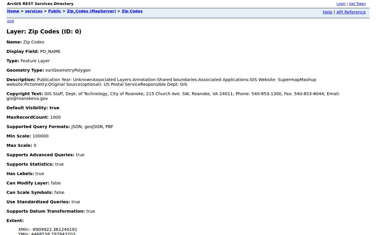
The service exposes OBJECTID, ZIP, PO_NAME, STATE, POP2000, and POP2010 fields and supports JSON, GeoJSON, PBF, query, and statistics functions. Its population fields belong to ZIP polygons and should not be presented as Cave Spring population.
Use the postal-place field as a map label, not a locality ruling. A Roanoke PO_NAME can appear alongside a Cave Spring-area address because the service follows postal geography. When a parcel question crosses the map edge, county GIS and the assessor's situs field remain better guides to the physical location and county jurisdiction.
| ZIP | Delivery-code attribute for locating the mapped polygon. |
|---|---|
| PO_NAME | Postal place name assigned to the polygon. |
| STATE | State abbreviation associated with the service feature. |
| POP2000 and POP2010 | ZIP-polygon map attributes, not an address-level or Cave Spring resident count. |
Verify Cave Spring ZIP Addresses
USPS ZIP Lookup is the address-level authority. The automated research session received a 403 response, which is a reason to verify manually rather than copy a ZIP from a third-party list. Enter the complete street, city, and state. If the USPS route is unavailable, use the county ZIP polygon only as a preliminary boundary check and retain the date checked.
- Enter the exact street address in USPS ZIP Lookup using street, city, and state.
- Compare the returned ZIP to the county polygon's ZIP and PO_NAME fields.
- Save the map source and date if the address lies near an edge.
- Use the confirmed street or parcel, rather than the ZIP alone, in county record tools.
No Cave Spring-specific ZIP split or realignment history was found in official sources. Treat a claimed historic ZIP change as an open research question until USPS documentation or a dated official map supports it.
Cave Spring ZIP Search Limits
ZIP geometry does not turn a map into a resident roll. WebPro's visible advanced form has no ZIP field. It accepts owner, parcel, street, number, building type, year, beds, baths, lot or finished size, neighborhood, land-use code, value, sales, and book or page. County VoterView accepts owner, address, or parcel; it does not provide a ZIP-wide public roster. Citizen Connect uses owner, parcel, or map routes rather than a verified ZIP filter.
| Portal | Visible Search Inputs | ZIP Search? | Use After ZIP Check |
|---|---|---|---|
| WebPro | Owner, parcel, street, number, property characteristics, sales, book/page | No visible ZIP field | Search the confirmed street, number, or parcel |
| VoterView | Owner name, address, or parcel | No public ZIP-wide route | Check polling or district information for a selected address |
| County GIS ZIP layer | ZIP attribute and mapped geography | Yes, geography query | Identify the polygon, then move to an address or parcel |
For a ZIP-wide property question, map the polygon first and then inspect the relevant parcels one by one. The map is spatial context, not proof of everyone connected to the polygon.
County GIS also supplies parcel, zoning, flood, school, district, and address-linked applications. These layers can explain why a map feature sits where it does, but they do not turn a ZIP polygon into a list of people. Pop-ups may need to be enabled, and county GIS databases refresh Thursday evenings with up to two hours for changes to propagate.
Cave Spring ZIP Record Workflow
A ZIP code can narrow geography, but the useful record keys are usually the street, parcel, situs address, or legal description. Keep the delivery ZIP separate from those county record keys. This avoids treating a nearby postal polygon as a jurisdiction line or drawing an unsupported conclusion about a person at an address.
- Verify the exact address through USPS and record the returned ZIP.
- Open the official local ZIP polygon to see whether the street is near a boundary.
- Find the street, number, owner, or parcel in WebPro and confirm the situs address.
- Use the parcel in county GIS for mapped context, then use VoterView only for its address or parcel function.
- For a street-by-street parcel sequence after the ZIP is confirmed, use the Cave Spring street directory.
Routes 419/Electric Road, US 220/Franklin Road, and US 221/Brambleton Avenue can appear in planning and address material. A road corridor can shape a place label without changing the parcel ID, which is why the parcel remains the durable bridge.
Cave Spring ZIP Address Labels
Postal, assessment, and recorded-land language serve different purposes. Use the term attached to the source rather than silently substituting one for another. That preserves the link between an old directory address, a modern county parcel, and the record that actually supports a conclusion.
For example, a newspaper may print a Roanoke route address, WebPro may display a situs street, the tax roll may send mail elsewhere, and a deed may name a subdivision or metes-and-bounds description. These are not interchangeable search keys. Retain each form with its source date, then use the tax-map parcel number to test whether the records refer to the same land.
- ZIP code
- A Postal Service delivery code. It does not define the Cave Spring CDP, county boundary, or planning area.
- ZIP+4
- An added delivery segment used to sort mail more precisely than the five-digit ZIP code.
- PO box ZIP
- A ZIP used for post-office boxes; it does not identify the physical location of every box holder.
- Unique ZIP
- A ZIP assigned for a single organization or high-volume mail destination, not a general neighborhood boundary.
- Carrier route
- A mail-delivery sequence within an area. It is not a county parcel boundary or resident roster.
Cave Spring ZIP Boundary Cautions
A ZIP can cross a Census place, planning area, county line, or independent-city line. Cave Spring has no separate incorporated city boundary, and its county records are held through Roanoke County. The City of Roanoke's similarly named systems do not become the right record source merely because a mailing label says Roanoke.
Historic research needs the same caution. City directories and newspapers may use Roanoke, Salem, Cave Spring, a route, or a former street label. Keep the printed address with the modern parcel identifier rather than silently assigning an old entry to one ZIP or locality. The county found no verified locality-wide renumbering year, so a changed-looking number needs a parcel, plat, or recorded legal description before it is treated as the same place.
A situs address is the physical parcel location. A mailing address is where tax correspondence goes. A legal description or plat is the recorded land identity. Keep all three with the confirmed ZIP, especially for historic street names or a conflicting post-office label. Note: No official exact Cave Spring ZIP crosswalk or full edge-address station assignment was found, so exact-address verification remains necessary.
When sources disagree, retain the conflict and ask the county custodian which field governs that record type.